Mountains of Nepal

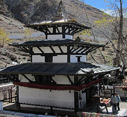
Nepal contains part of the Himalaya, the highest mountain range in the world. Eight of the fourteen eight-thousanders are located in the country, either in whole or shared across a border with Tibet or India. These awe-inspiring, majestic mountains of Nepal attract the tourists from far and wide. Adventure activities like mountaineering, trekking and hiking can be enjoyed in this mountain range. Journey on these mountains transcends one to an entirely different world.

Mountain Height Ranking in the World
Everest 8848m (29028ft) Highest mountain in the World
Kanchenjunga 8586m (28169ft) # 3
Lhotse 8501m (27890ft) # 4
Makalu 8463m (27765ft) # 5
Cho Oyu 8,201m (26,906ft) # 6
Dhaulagiri 8167m (26794ft) #7
Manaslu 8156m (26758ft) # 8
Annapurna 8091m (26545ft)
# 10

Mt Everest

Mt Everest is the highest mountain in the world measuring 8,848m (29,028feet) in height. It was first climbed on May 29, 1953 by a New Zealander Sir Edmund Hillary and Tenzing Norgay of Nepal .Mount Everest is also known by the Tibetan name Chomolangma (goddess mother of the snows), and by the Nepali name Sagarmatha (Mother of the Universe).

Everest had been attempted many times before the important expeditions being that of 1922, 1923 and 1924. The body of George H.L. Mallory, who died in an earlier attempt (1924), was discovered on the mountain in 1999.More than 600 climbers from 20 countries have climbed the summit by various routes from both north and south. Climbers’ ages have ranged from nineteen years to sixty. Climbing on Everest is very strictly regulated by both the Nepalese and Chinese governments. Climbing Everest treks to Everest Base Camp are becoming increasingly popular on both the north and south sides of the mountain .On the north side, a Buddhist monastery is one of two whose locations were selected specifically to allow religious contemplation of the great peak. The other side is the Thyangboche Monastery in Nepal. The once active Rangbuk monastery in Tibet has required much rejuvenation from the destruction it experienced following China’s invasion of Tibet.

Kanchenjunga

Kanchenjunga (8,586) is the third highest mountain in the world. From 1838 until 1839 was believed to be the highest .It is an enormous mountain –mass and many satellite peaks rise from its narrow icy ridges. It is located on the border of Nepal and Sikkim, just 46 miles northwest of Darjeeling .It is the most easterly of the great 8,000 meter peaks of the Himalaya.

Though not successfully climbed until 1955, it was first attempted in 1905, but four members of that international party were killed in an avalanche. As inspiring as Kanchenjunga’s beauty is at least the first three parties to ascend the mountain never attempted the final few feet to the summit our of voluntary respect or those who considered the summit sacred. The successful British expedition of 1955 set the standard by stopping a few feet short of the actual summit, in honor of the local religion.

Lhotse

Lhotse (8,516) is the fourth highest mountain in the world. Its long east-west crest is located immediately south of Mount Everest and the summits of the two mountains are connected by the South Col, a vertical ridge that never drops below 8,000 meters. Lhotse is sometimes mistakenly identified as the south peak of the Everest massif. No serious afternoon was turned to climbing Lhotse until after Everest had finally been ascended. Lhotse was first climbed in 1956 by two Swiss, Fritz Luchsinger and Ernest Reiss.

In addition to the main summit, there are two subsidiary peaks, Lhotse Shar, which is immediately east of the main summit, and Nuptse, a high peak on the mountain’s west ridge.

Makalu

Makalu (8,463) is the fifth highest mountain in the world. It is an isolated peak, located just 14 miles east of Mount Everest. Its size alone is impressive, but its structure, that of a perfect pyramid with four sharp ridges, make this mountain all the more spectacular.

It has proved to be a challenging climb, as only five of its first sixteen attempts were successful. Previously, it had been admired and studied by several Everest parties, but like so many other giants in Khumbu region, it was not attempted until the summit of Everest had been attained in 1954.A French group first climbed Makalu in year 1955.

Chomo Lonzo(25,650 ft) is a subsidiary peak of Makalu, rising just north of the higher summit, separated by a narrow saddle.

Cho Oyu

Cho Oyu (8,201) is the sixth highest mountain in the world, located a short distance to the west from Everest and Lhotse (the fourth highest) in the Khumbu region of Eastern Nepal along the Tibetan Border, its towering peak stands with Everest well above the surrounding mountains. It become a familiar landmark to climbers ascending Everest ‘s north face .Just west of Cho Oyu is the Nangpa La, a 19,000- foot glacier pass, and the main trade route between the Khumbu sherpas and Tibet. Cho Oyu’s proximity to the Nangpa la has earned it the distinction among some climbers as being the easiest 8,000 meter peak. It was the third such peak climbed, and the first climbed in autumn by two Australian.

Dhaulagiri

Dhaulagiri (8,167), whose name means White Mountain, is the seventh highest mountain in the world. It is an enormous Himalayan massif, located in north central Nepal. After its discovery by the western world in 1808, it replaced Ecuador’s Chimborazo (20,561 ft) as the postulated highest mountain in the world. It maintained this standing for nearly 30 years, until the discovery of Kanchenjunga which was then falsely believed to be the world’s highest mountain.

Dhaulagiri’s crest stretches for thirty miles, lending structure to an otherwise tangled topography of twisting ridges, glaciers, and ice falls. Along the main crest, several pyramid-shaped peaks rise. Four of these summits, numbered form east to west, rise above 25,000 feet.

In 1960, the Swiss/Australian expedition who first reached the summit did so despite their airplane having crashed during the approach. This was the first Himalayan climb supported by an airplane, although the plane was subsequently abandoned on the mountain.

Manaslu 

Manaslu (8,163) is the peak of the Gorkha massif, and is the eight highest mountains in the world. It is located about 40 miles east of Annapurna, the tenth highest mountain. The mountains long ridges and valley glaciers offer feasible approaches from all directions, and it culminates in a peak that towers steeply above its surroundings landscape, and is dominant features when seen from afar. The name Manaslu is derived from the Sanskrit word Manasa and can be roughly translated as mountain of the spirit. An all-female Japanese expedition successfully ascended to the summit, thereby becoming the first women to climb an 8,000 meter peak.

Annapurna

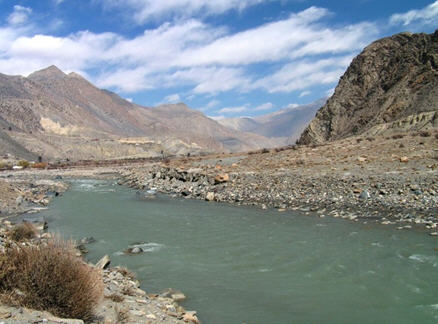
Annapurna (8,091) is an enormous Himalayan massif, the tenth highest mountain in the world. In 1950, it becomes the first 8,000 meter mountain to be successfully climbed. It is located east of great gorge cut through the Himalaya by the Kali Gandaki River. The mountain has the glaciers on its western and north western slopes, which drain into the gorge.

Annapurna is a Sanskrit name that can be translated as goddess of harvests or more simply the provider. Of Annapurna’s many highs peaks, five are labelled using some variations of the name Annapurna. Of these, the two highest (Annapurna I and II), stand like bookends at the western and eastern ends of the massif.

River Basins of Nepal

The splendid rivers of Nepal can be divided into three categories in accordance to their origins. The first category comprises the three main river systems of the country – the Koshi, Gandaki and Karnali river systems, all of them originating from glaciers and snow-fed lakes.

The Koshi River System
• The Koshi river system consists of Tamor, Arun, Dudhkoshi, Likhu, Tamakoshi, Sunkoshi and Indravati rivers.
• The Arun and Sunkoshi originate in Tibet. The confluence of these rivers is at Tribeni (near Dharan) in Sagarmatha Zone.
• Flowing for almost 10 kms through a narrow gorge before entering the plains, the ‘Sapta Kosi’ or simply the ‘Koshi’, swollen with the waters of the seven rivers, finally merges into the Ganges.
• The Kali Gandaki originates in Mustang and converges with the Trishuli at Deoghat in Chitwan. The river is then called the ‘Narayani’ and goes on to meet the Ganges.

The Gandaki River System
• The Kali Gandaki originates in Mustang and converges with the Trishuli at Devghat in Chitwan. The river is then called the ‘Narayani’ and goes on to meet the Ganges at Patna in Bihar.
• The Gandaki river system in central Nepal consists of the Kali Gandaki, Budhi Gandaki, Marsyanghi, Trishuli, Seti, Madi and Daraundi rivers.
• The Kaligandaki is the longest river and the Trishuli, the main tributary of this system.

The Karnali River System
• The Karnali river system in Western Nepal consists of the Humla Karnali, Mugu Karnali, Seti and Bheri rivers and is the longest river system in the country.
• The Humla Karnali, which rises in Tibet, is the main tributary. After entering India, this river assumes the name Gogra.

Janakpur

A great religious place, Janakpur is famous as the birthplace of Goddess Sita, the consort of Lord Rama. There is an artistic marble temple of Sita (Janaki), popularly known as Naulakha Mandir. Religious festivals, pilgrimages, trade fairs and other festivities are held here on Bivaha Panchami and Ram Navami days. Janakpur is also linked with Kathmandu by air and road.

For more details read on the link

Baraha ksetra (Varaha ksetra):

ksetra (Varaha ksetra)

The second largest city of Nepal is Biratnagar which is situated in the Koshi Zone .A few kilometers from the main city of Biratnagar, Barahaksetra, the holy place of Hindu pilgrimage, lies at the confluence of the two rivers the Saptakoshi and Kokaha. There is the temple of Lord Baraha, Lord Vishnu, by taking the incarnation of a boar (Baraha) protected the earth from being submerged into Patal (underworld) with his long tusk. Then the Lord sat with his wife Laxmi at the bank of Koshi River and the lap of Himalayas and hills. So, the place bore its name after that event. There is a big and beautiful image of the Baraha incarnation of Lord Vishnu. Biratnagar is linked with Kathmandu by air and road

It is believed that all wishes are fulfilled during life and one gets the eternal grace from Lord Vishnu after death if one takes holy dips at the confluence of Koshi and Koka rivers and worships god at the temple. Shradda performed at this place has greater value than that performed at Gaya.

Baidyanath kshetra :

Baidyanath kshetra is located in Achham district, the far western region of Nepal, at the right bank of Briddaganga River, one of the four important regions of Aryavarta, the land of Aryans. The places described in Manaskhanda of Skandapurana are as follows

Baidyanath based in Garudagunj, is famous as a place where Goddess Parvati was married to Lord Shiva. – Four sites (Chardhama): Kailash, Manasrovar, Khocharnath and Achham-based Baidyanath. The following lines are the holy words of Lord Shiva himself. “Gods get medicines of thousands of diseases and pray me as baidyanath (lord of medicines) and get rid of problems”.

Baidyanath kshetra

It is one of the four religious sites, Chardhama of Nepal; Pashupat Kshetra, Muktinath Kshetra, Baraha Kshetra, Baidyanath Kshetra. Baidyanath is described as a savior / redeemer for the devout. This is believed to be the place where Ravana, the antagonist in The Ramayana, sat in penance in devotion of god.

Licensed Guides:
All the travel agencies of Kathmandu have licensed English speaking guides, however, many agencies have also guides who can speak other international languages for the convenience of tourist. As unlicensed guides are not allowed to serve clients, it is advisable to confirm that your guide has valid licence. To have a quality service, it is recommended to arrange the sightseeing programmes only through the government registered travel agencies.

Muktinath

Muktinath

Muktinath

The famous temple of Lord Muktinath lies in the district of Mustang and is situated about 18 kilometers north east of Jomsom at an altitude of about 3,749 meters. The temple is situated on a high mountain range and is visited during fair weather. Situated at the base of the Thorong La mountain pass, Muktinath is a highly venerated sacred place for both Hindus and Buddhists.

Hindus call the site Mukti Kshetra, which literally means the “place of salvation” and it is one of the most ancient temples of the Lord Vishnu and the Vaishnava tradition in Nepal. The shrine is considered to be one of the eight sacred places known as Svayam Vyakta Ksetras (the other seven being Srirangam, Srimushnam, Tirupati, Naimisharanya, Totadri, Pushkar and Badrinath), as well as one of the 108 Divya Desam, or holy places of worship of Lord Vishnu. Additionally, it is also one of the 51 Shakti Pitha goddess sites.

The temple is small and contains a life-sized golden statue of Vishnu as Shri Mukti Narayana. In addition to Mukti Narayana, the temple has bronze deities of Bhoodevi (the Earth-goddess form of Lakshmi), the goddesses Saraswati and Janaki (Sita), Garuda (the mount of Vishnu), Lava-Kusa (the sons of Rama and Sita) and the Sapta Rishis (Seven Sages created by Lord Brahma). There is an old Buddhist monk present in the temple and worship is conducted by Buddhist nuns.

Muktinath

Behind the temple is a semi-circular wall with 108 stone faucets at a height of seven feet. All the faucets have the same shape of the head of a bull and are separated by approximately one foot. Water from the ice-cold Kali Gandaki river has been diverted to flow through the mouths of these bulls and hardy pilgrims who visit the temple often stand beneath each of the spouts.

The Kali Gandaki riverbed downstream from Muktinath is the source of the rare Shaligram stones. The Holy stones are available all the way from Damodar Kunda to Gajendramoksha Divyadham.

All four species: Jarayuj (root breed), Swoidesh (self breed), Andaj (egg breed), and Udima (birth breed) who visit the place and worship gods get salvation after their death.

Besides Lord Vishnu, Brahma and me with other gods and sages shall be with you, says Lord Shiva while pronouncing the sacred value of the place. To have a holy dip at Krishna gandaki is equal to hundred holy dips at other pilgrimage sites in terms of the salvation.

]Muktinath

Buddhists call Muktinath as Chumig Gyatsa, which in Tibetan means ‘Hundred Waters’. According to Tibetan Buddhism Chumig Gyatsa is a sacred place of the Dakinis goddesses known as sky dancers, and also one of the twenty four celebrated tantric places. Additionally, the site is believed to be a manifestation of Avalokitesvara, the Bodhisattva of compassion and virtue. The Tibetan Buddhist tradition states that Guru Rimpoche, also known as Padmasambhava, the founder of Tibetan Buddhism, meditated here on his way to Tibet.

After completing prayers and worship at the Muktinath temple, many pilgrims both Hindu and Buddhist, visit Mebar Lha Gomba, the small monastery of `miraculous fire’, which is situated near the entrance gate of the temple. This monastery, dedicated to Guru Rimpoche (Padmasambhava) and containing a statue of the Buddhist deity Chenrezig (Avalokitesvara), is famous for its continuously burning natural gas fire, which Hindus worship as Jwala Mai, the Goddess of Fire.

Damodar kunda

Damodar kunda

Damodari Ganga springs along Shaligram Parvat which contains Shaligram (sanctifying sacred stones)

It is the holy part of Damodar Himal elevated to 22,000 feet high from sea level situated in Mustang district.

There are numerous sanctifying glacial lakes, both small and large, where Damodari Ganga takes her form, Damodar kunda being the largest one. As a confluence of lakes and ponds such as Brahmakunda, Rudrakunda and Anantakunda; Damodarkunda contains the largest volume of water. Damodarkunda, the estuary of Krishnagandaki river, is one of the holiest pilgrimage sites for Hindus. Several colophons of religious scriptures describe the heavenly bliss of this Kunda (sacred pond).So, it bears both religious and historical importance. A unique place to feel ecstasy of self and be transported to holy bliss. Damodarkunda is one of the holiest of terrestrial shrines, so it is reverently described in Puranas, the holy books of Hinduism. Among six Goswamis, Srila Gopal Bhatt Goswami visited this place and it was here while bathing that few shalagram shilas jumped into his hands which he carried it with him as Lord’s desire to Vrindavan dham, where they are still worshipped today in the temple and one of which miraculously transformed as Shri Shri Radha Ramanji.

Shri Shri Radha Ramanji.

Shaligram

Shaligram

Shaligram

Gloriously described in Puranas as Krishnagandaki (Black Gandaki) as well as Chakranadi, and worshipped as one of the holiest rivers, Krishnagandaki consists of seven Gandaki rivers supposed to have sprung from cheek (Gandasthal) of Lord Vishnu. It has a distinct honor of being the only river in the world to contain sacred stones (Shaligrams). Shaligram forms the stone incarnation of Lord Vishnu. Devout worship these stones at their homes with utmost reverence and devotion.

Krishna gandaki, inexhaustible reservoir of Shaligram starts from Damodar Himalaya and flows southward through Mukti Kshetra (the place of salvation).According to the Varaha Purana, the place is named after a sage Gandaki, who sat in a penance here. The Krishna Gandaki river is said to have sprung as perspiration from the cheek (Gandak) of the Lord Vishnu and hence the name Gandaki.

Kaagabeni

Kaagabeni

According to the Puranas, this place been named after the famous crow bodied sage called Kaga bhusundi who sat in penance at this place. Kaagaveni lies at the bank of Kali Gandaki River on the way to Muktinath few miles away from Jomsom. This is renowned as a confluence of two rivers: Krishna Gandaki and Kaga Khola . One who performs Pitree Shradda (a rite performed to commemorate the death of the elders’ esp. parents) near Kagaveni can easily facilitate the dead towards redemption. The value of Shradda at this place is many times more prominent than that at Gaya.

Pokhara Valley :

The Pokhara Valley – one of the most picturesque spots of Nepal, is enhanced by its lovely lakes Phewa, Begnas, and Rupa. Situated 200 kilometers west of Kathmandu, Pokhara is connected by air as well or by bus from Kathmandu and Bhairahawa a border town near India. Situated at an altitude of 827 meters from the sea-level, Pokhara offers the magnificent views of Dhaulagiri, Manaslu, Machhapuchhre, five peaks of Annapurna and others.

“]Lumbini

Lumbini